Every year, monsoon seasons bring vital rainfall to many parts of the world, supporting agriculture and replenishing water resources. However, these same rains often trigger severe flooding, putting millions of lives, homes, and crops at risk. As climate patterns shift and storms intensify, governments are turning to monsoon flood mapping as a key tool for predicting and managing flood events. Accurate mapping systems provide essential data that help authorities prepare emergency plans, protect vulnerable populations, and deploy resources more effectively. The integration of advanced technology has transformed the strength and speed of disaster response, making communities better equipped to endure the challenges of monsoon seasons.
Why Monsoon Flood Mapping Is Essential for Modern Preparedness
Flooding during monsoons can happen quickly and unpredictably, leaving little time for evacuation or protective measures. This makes monsoon flood mapping crucial in forecasting potential flood zones, water levels, and risk patterns. Governments use these maps to identify areas that require early warnings or evacuation plans.
Mapping systems also play a vital role in infrastructure planning. Knowing which areas are prone to flooding allows engineers to design stronger bridges, drainage systems, and protective barriers. By incorporating accurate flood data, cities and rural regions can better prepare for future monsoon seasons. This proactive approach significantly strengthens disaster response and reduces loss of life and property.
How Technology Enhances Flood Mapping Accuracy
Modern flood mapping relies on advanced technologies that provide real-time monitoring and predictive insights. Satellite imagery, geographic information systems (GIS), drones, and hydrological models work together to produce detailed and reliable maps. These tools create a clearer picture of how rainfall interacts with river systems, soil conditions, and topography.
Such precision helps authorities understand the intensity and direction of floodwaters, allowing timely disaster response actions. Remote sensing and radar technology can detect rising water levels long before floods become visible on the ground. This capability is especially important in remote or densely populated regions where manual monitoring is difficult.
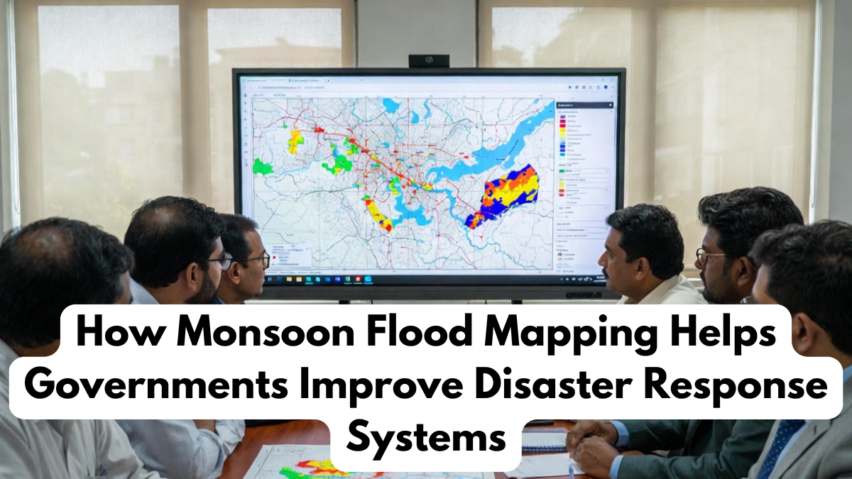
Key Components of Monsoon Flood Mapping Systems
Flood mapping systems involve a combination of data sources, analysis techniques, and technological tools. The table below highlights essential components of monsoon flood mapping and their contributions to effective disaster response:
| Mapping Component | Description | Contribution to Disaster Response |
|---|---|---|
| Satellite Imagery | Captures large-scale rainfall and water spread | Helps monitor regional flood patterns |
| Remote Sensing | Uses radar and sensors to measure water levels | Provides real-time alerts and early warnings |
| GIS Software | Integrates geographical and environmental data | Creates accurate flood risk maps |
| Hydrological Models | Predict how water flows through terrain | Supports evacuation planning and resource allocation |
| Drone Surveys | Capture detailed visuals of affected areas | Improves response accuracy and damage assessment |
These tools collectively ensure that flood predictions are reliable, timely, and actionable.
Strengthening Disaster Response Through Better Planning
The true value of monsoon flood mapping lies in its ability to improve preparedness and response strategies. With precise information, governments can strengthen early warning systems, deploy rescue teams more efficiently, and position emergency supplies in strategic locations.
Early alerts allow communities to evacuate safely before waters rise. Mapping also guides long-term development plans by identifying safe locations for schools, hospitals, and housing. When integrated with communication networks, flood maps ensure that people receive accurate information, reducing panic during emergencies. This coordinated approach enhances disaster response, helping save lives and minimize damage.
Supporting Recovery and Long-Term Resilience
Monsoon flood mapping is not only useful before and during flood events—it is just as important afterward. Once waters recede, maps help assess damage, identify areas in need of immediate support, and guide reconstruction efforts. Governments can use this data to design long-term resilience strategies, such as improving drainage systems, reinforcing riverbanks, or relocating high-risk communities.
This long-term perspective strengthens communities’ ability to handle future monsoon seasons. By using monsoon flood mapping consistently, policymakers can build smarter, safer environments and reduce long-term vulnerability. Strong disaster response combined with sustainable planning helps ensure communities recover faster and remain resilient.
Conclusion
Monsoon flood mapping has become an indispensable tool for managing the growing risk of seasonal flooding. With advanced technology and accurate data, governments can predict flooding more effectively, issue early warnings, and organize rapid disaster response operations. These systems not only save lives but also support long-term resilience and infrastructure planning. As extreme weather events continue to rise, flood mapping will remain central to protecting vulnerable communities and building a safer, more prepared future.
FAQs
How does monsoon flood mapping help during disasters?
It provides early warnings and accurate data, improving disaster response and evacuation planning.
What technologies are used in flood mapping?
Satellites, GIS software, hydrological models, and drones all support monsoon flood mapping.
Why is flood mapping important for governments?
It helps identify risk zones, improve infrastructure, and strengthen disaster response systems.
Can mapping predict the severity of floods?
Yes, advanced models can forecast water levels and flood intensity with high accuracy.
How does flood mapping support long-term resilience?
It guides reconstruction and planning strategies that reduce vulnerability in future monsoon seasons.
Click here to learn more